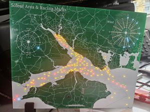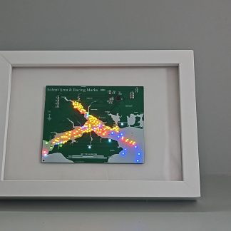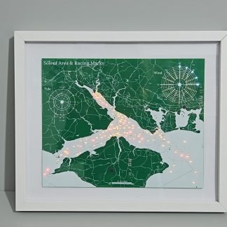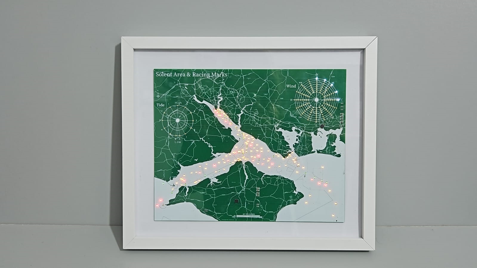
Description
Wind
Mean wind speed and direction are shown from f3 to f10 as a sequence of bright white LEDs. A dim LED indicates the wind gust.
Temperature
From 2 to 30 degrees celcius on the outer ring of the wind indicator. This may mask f10 winds in certain direction and temperature combinations.
Tide Indicator
Hours to next high or low tide event. Tide times are taken for Portsmouth Harbour.
Navigation Markers
Red and green navigation markers included. The 4 yellow carrier lights are illuminated occasionally. We do not have an automated feed for carrier lights at this time.
The Needles lighthouse will flash indicating it is receiving data from the server.
Racing Markers
Yellow racing markers are illuminated randomly. Specific races can be replayed illuminating the markers in race order. Please feel free to request specific races and they can be added to the sequence of animations.
Offline Mode
The map will show a sequence of animations when not connected to the internet. It will periodically attempt to re-establish a connection to the internet.
Wind and tide data are not available when in offline mode.
Tide Animation
Periodically the ingress and egress of the tide will be shown as an animation through a ‘wave’ of light through the markers.
Automatic Updates
On start-up the unit will verify it is running the latest version of the software. If the next version is available the unit will download, install and restart using the newer version.
Future Updates
The wind indicator behaviour will be enhanced to provide a forecast od wind direction and speed.